
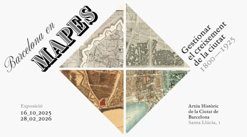
Imagine Barcelona, not as the modern and vibrant city we know today, but as a modest 19th century enclave surrounded by walls. This was a reality before countless projects transformed its urban landscape. An immersive exhibition at the Historical Archive of the City of Barcelona invites us to explore these evolutionary changes through the exhibition entitled “Barcelona in Maps: Managing the Growth of the City (1800-1925)”.
The visual narrative of Barcelona
The exhibition, which opens its doors from October 16, 2025 until February 28, 2026, makes a visual retrospective of the city through 25 magnificent maps. These maps, carefully preserved in the Historical Archive, each represent a crucial chapter in the urban planning process that Barcelona underwent from 1800 to 1925. This era marked a before and after in Barcelona’s history, transforming its morphology in such a profound way that it required meticulous cartography to manage urban growth.
Five stages of urban metamorphosis
The exhibition is structured into five historical periods, each represented by maps illustrating the crucial stages of the city’s growth. These maps not only show the evolution of the urban landscape, but also narrate the multiple layers of human effort and ingenuity behind each expansion project.
The setecientist heritage
The first area, “Background: the setecientista heritage”, takes us back to the previous century. We can see a representation of Barcelona before 1714 without the Ciutadella. Moving forward in time, a map from 1740 shows us the new face of the city with the military building completed. Through these maps, we can see the legacy of the 18th century and the foundations of what was to come.
Modernization in the 19th century
As Barcelona moved into the 19th century, the city began to face space problems due to population growth within its walls. The “Modernizing the City” section exhibits an exceptional French army map of the world, produced between 1823 and 1827, which uses contour lines. This was an innovative approach for the time and can be consulted online for a more detailed look.
L’Eixample: a new model
One of the most striking changes came with the beginning of L’Eixample, when the walls were demolished to make way for an ambitious urban plan. Ildefons Cerdà’s 1859 map exemplifies this transformation. Its design evidenced the desire to create a more modern and functional city.
Renovations in the old town
Despite the growth on the outside, insalubrity remained a problem inside the walls. The section dedicated to “The reform of the intramural city” highlights a map of the old town by Miquel Garriga i Roca. It illustrates how challenges continued within the old urban layout. In addition, a digital resource complements this story by allowing a virtual look into the past.
Challenges of a growing city
Finally, the last area takes us to a Barcelona that begins to absorb surrounding municipalities from 1897. This process, which doubled the population and quadrupled the municipal space, is reflected in general and detailed maps. These show everything from new municipal boundaries to the layout of essential facilities.
Barcelona’s confusing orientation
As a highlight, the exhibition presents an interesting detour on the commonly confused orientation of maps of Barcelona. It is often assumed that the Tibidabo mountain represents north because of its location on maps. However, the geographic layout of Barcelona means that northeast is actually where north is located.
In short, this exhibition at the Historical Archive offers not only a fascinating journey through the cartographic evolution of Barcelona, but also a profound reflection on the urban challenges that led this unique city to become what it is today. It is a unique opportunity for those who wish to understand Barcelona from its foundations.
—